


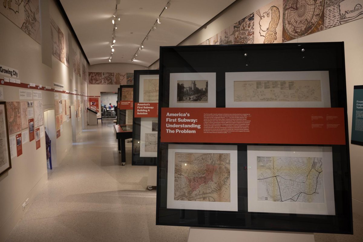
“Getting Around Town: Four Centuries of Mapping Boston in Transit,” located in the Norman B. Leventhal Map & Education Center in the Boston Public Library, is the first transit map exhibit at the center and displays more than 400 years of the Boston’s transit system’s history through an extensive collection of maps, primary documents and artifacts.
Steven Beaucher, guest curator of the exhibit and author of “Boston in Transit,” the book the exhibit stems from, displays his personal collection of artifacts and maps, along with the Leventhal Map Center’s collection, to showcase the deep history of Boston transit.
“I wanted to show people that Boston was a leader globally in forms and methods [of transit], and everything from vehicles to how they manage systems,” Beaucher said.
Most people ask him about the history of the Massachusetts Bay Transit Authority, or the MBTA, but the history of the transit system goes much deeper and further back than the authority’s establishment, Beaucher said.
Garrett Dash Nelson, president and head curator of the Leventhal Map & Education Center, echoed this sentiment. He hopes understanding the depth of the history of the MBTA is one of the main takeaways visitors get from the exhibit.
“It is in our genesis to have some kind of form of public transportation,” Beaucher said.
An expert in the history of the MBTA and the Metropolitan Transit Authority, or MTA, Beaucher noteshow influential and progressive Boston has been in the sphere of American public transportation. The MBTA is the current system that replaced the MTA when it expanded to 78 towns and cities. He wanted to show this in the exhibition, highlighting the multifaceted nature of the transit system and the intricate details of transit maps through Boston’s history.
Visitor Daphne Layton, a Somerville resident, expressed a similar observation. She said it was interesting to see the old maps and how the city and transportation system have evolved over time.
Another crucial element of the exhibit is how it connects with its audience. Nelson and Beaucher both hope visitors can see the maps represent far more than information — they are also tools for understanding history and what the future could hold.
“We worked with some high school students from Boston Public Schools, and we had them look at equity and issues in the system by making their own maps and by thinking about how they remix those maps,” Nelson said.
While most maps in the exhibition were made by professionals, such as engineers, draftspeople and cartographers, both curators said maps are becoming more accessible.
“We are no longer just consumers of maps; we are the makers of maps too,” Nelson said.
Creating a personal connection between the maps in the exhibit and the visitors was a top priority for Beaucher. He wanted to help the guests explore the “what ifs,” or variations of what transportation maps and routes could have been and develop a personal connection to what they saw. An unbuilt transit map from 1945 can be seen in the exhibit, showing plans to expand the MBTA to the greater Boston area. While some of the plans didn’t go into effect, they depict the realized possibilities of the MBTA and how it could continue to expand and improve.
“They thought big,” Beaucher said.
While the future of the MBTA is still unknown, it is clear the public, as well as professionals in the non-profit and private sectors, have ideas on how to further develop the system and address ongoing problems of “consistency” in funding, management and operation, Beaucher said. The exhibit highlights not only the deep history of the system but also includes the public through interactive elements: asking visitors how they would alter the system and displaying the maps Boston high school students created.
“There is an intimate connection between past, present and future, and that’s always at the forefront of our exhibitions, to learn from the past, think about how we live today and maybe ask some questions about the future,” Nelson said.
“Getting Around Town” will be open until April 27 and will be followed by a new temporary exhibit, “Heaven and Earth: The Blue Maps of China,” set to May 10. “Getting Around Town” can also be visited digitally.
Correction: This story was updated Feb. 16 at 3:47 p.m. to correct the spelling of Steven Beaucher.