Boston is commonly known as one of the more walkable cities in the United States, with its urban landscape presenting plenty of exciting activities and interesting opportunities within easy reach. But not as many people realize that just a short drive outside of city limits can get them to some of Massachusetts’ most beautiful — and historical — natural areas. These treasure troves are not only perfect for an early morning hike, afternoon picnic or evening sunset, but they are also the sites of some very notable moments in state and national history.
Massachusetts is home to 154 state parks, according to the official Commonwealth website, with locations ranging from within Boston city limits to towns a little further out, like Hingham and Saugus. They are not all just average parks, however, with some of them also categorized as forests, reservations, trails and even golf courses. Regardless, they are all protected areas established to preserve some inherent significance, whether that be the natural beauty they showcase or the historical sites and remnants they house — all for the public to enjoy.
Massachusetts is also home to 16 national parks, as deemed by the National Park Service. Similar to the state parks, they span across several towns and are protected to preserve local history, heritage and opportunities for nature activities. Especially in recent years, there have been more efforts from several organizations, like the National Park Conservation Association, to maintain these areas. The negative consequences of climate change are old news, but these organizations also work to mitigate the challenges from air and water pollution, oil and gas structures and overcrowding.
This year, the park service is celebrating National Park Week, a nine-day celebration between April 22 and April 30 that brings deserved attention to the more than 400 national parks all over the country. On April 22, which was also Earth Day, all entrance fees to national parks were waived. Every day following there has been a variety of programs, events and activities encouraging the public to engage with the parks. Along with the blossoming April weather, this might be the perfect time to visit some of Massachusetts’ national parks, like Minute Man National Historical Park in Lincoln or the Boston Harbor Islands, scattered throughout eastern Massachusetts.
Throughout the week, the park service is encouraging its staff members as well as the general public to share the special stories they have from, or associate with, national park areas, using #MyParkStory. They even have daily prompts for each park story, such as sharing a story of “gratitude” April 26 or a story of “inspiration” April 28.
Not all the places I visited and photographed were national parks, but here’s #MyParkStory: These photos were primarily taken in March, as the state was still emerging from its, albeit mild, winter. Although it was not the season when most people venture out into these remote areas, these photos serve as reminders of the immense beauty and natural serenity these places still hold, even when the colder months can bring barren trees, forceful winds and darker skies. Living in a bustling city makes quiet moments among nature all too rare, so I was immensely grateful for the days I spent just wandering around and enjoying the natural beauty around me.
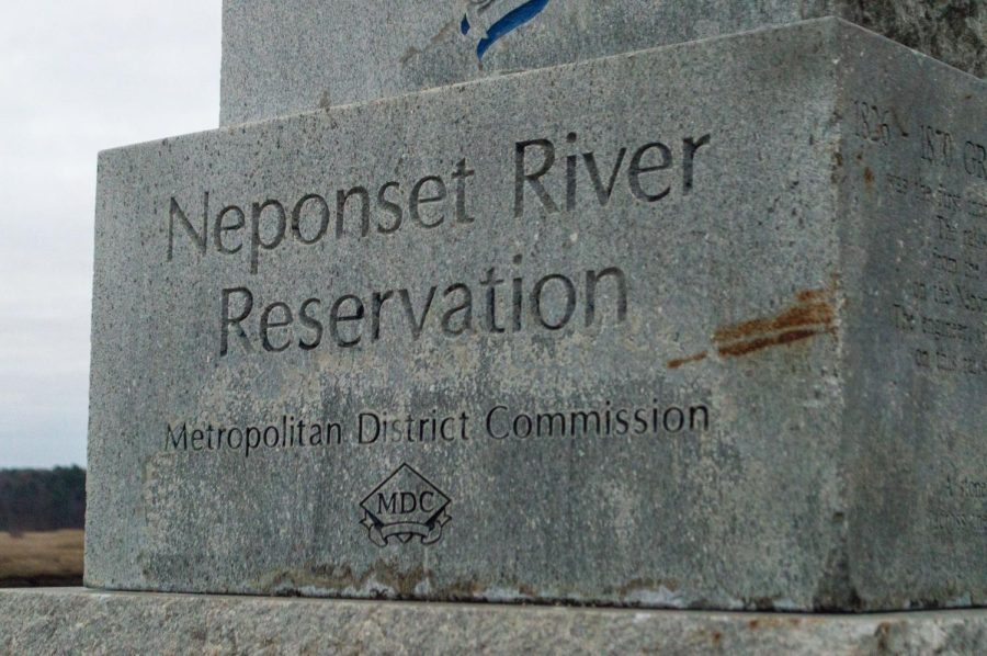
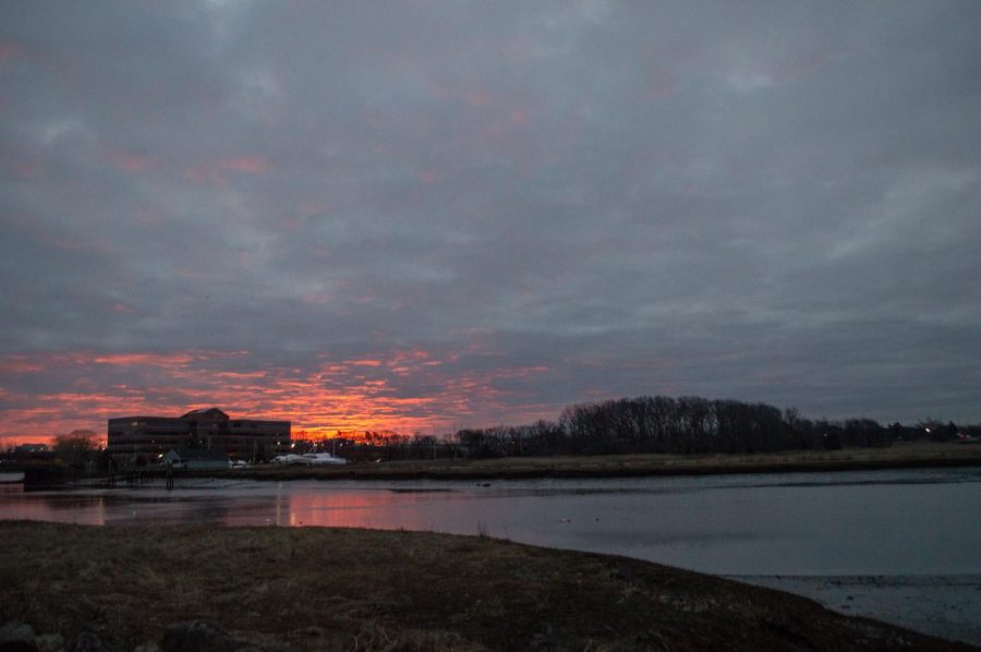
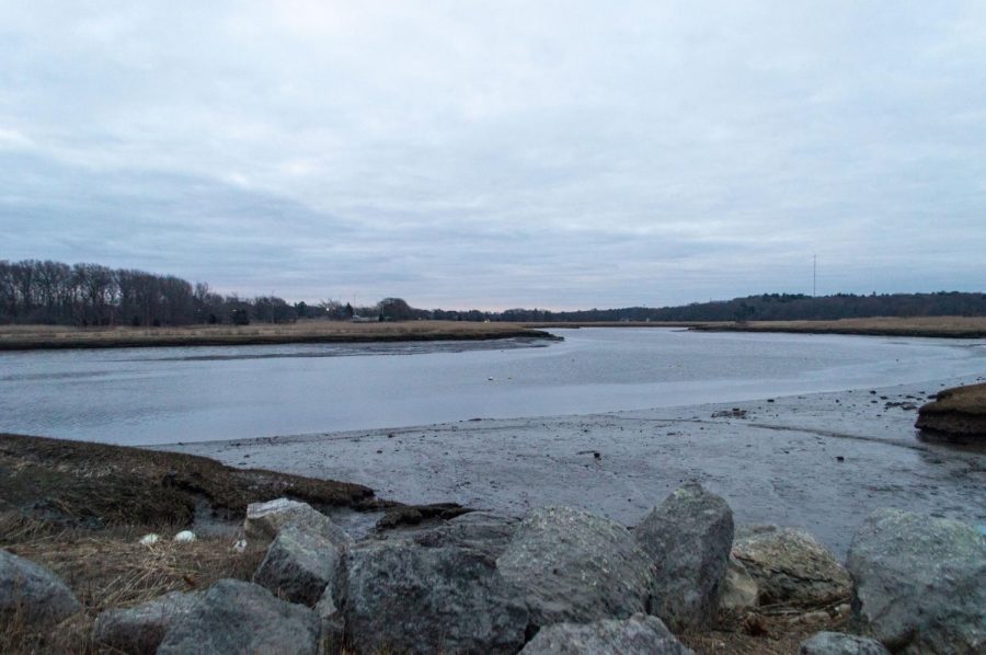
1. Neponset River Reservation — approximately 6.4 miles from campus
Right before the crack of dawn, a gray slab sign marks the Neponset River Reservation in Milton. The 30-mile-long river stretched from Milton to Boston Harbor. (Pavithra Rajesh)The sunrise brilliantly illuminates the cloudy sky surrounding the river. Neponset River Reservation has been a relaxing spot for early-morning walkers and hikers, with the 2-mile Quincy Riverwalk offering spectacular views throughout. (Pavithra Rajesh)The Neponset River is still and silent in the minutes just after sunrise. Outside of its many marshlands and freshwater wetlands, the river has been an ideal location for boating and kayaking. (Pavithra Rajesh)
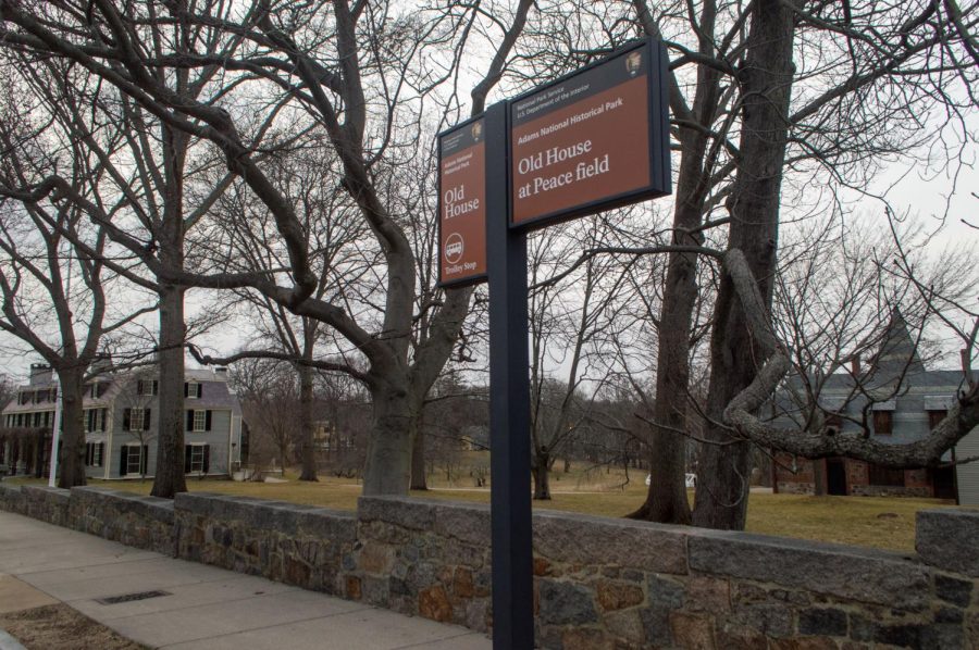
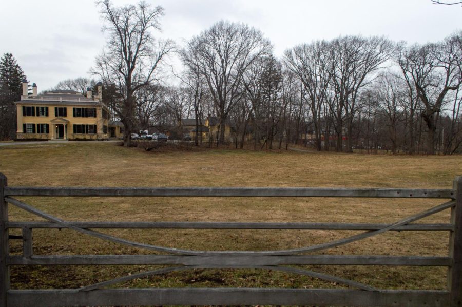
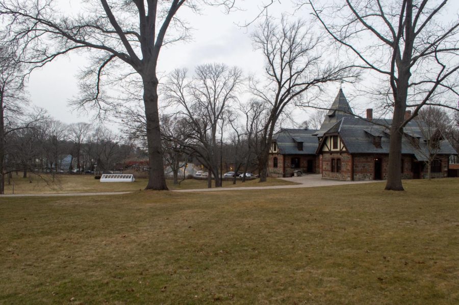
2. Adams National Historical Park — approximately 9.5 miles from campus
On a gloomy evening, a sign reads “Old House at Peace field” at Adams National Historical Park in Quincy. The historic Old House (far left) was originally built in 1731 and housed four generations of the Adams family — starting with founding father and former president John Adams and his wife and civil rights advocate, Abigail Adams. (Pavithra Rajesh)A fence stands at the edge of Adams National Historical Park. The gated park area was open throughout the day for visitors to tour and enjoy, with hours varying by season. (Pavithra Rajesh)The Carriage House stands among barren trees at Adams National Historical Park. Charles Francis Adams Sr., John Adams’ grandson, built the house in 1873 to store their carriage and horses and as a home for their coachman. (Pavithra Rajesh)
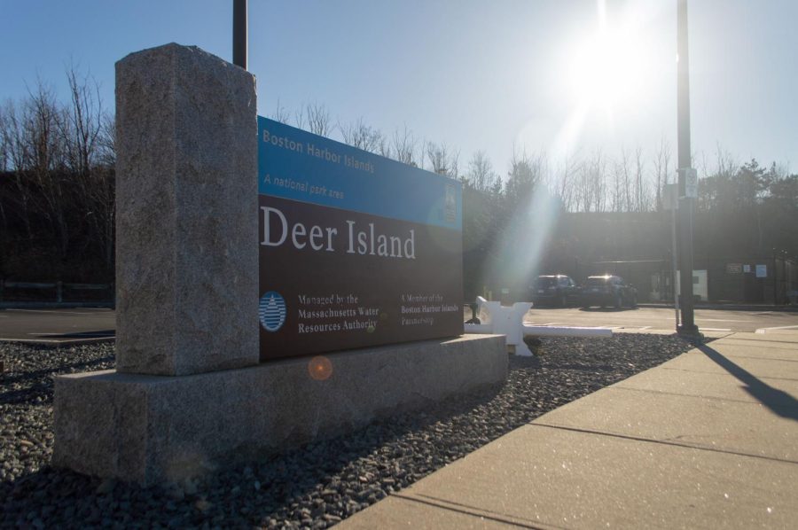
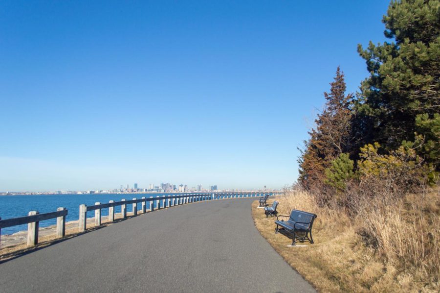
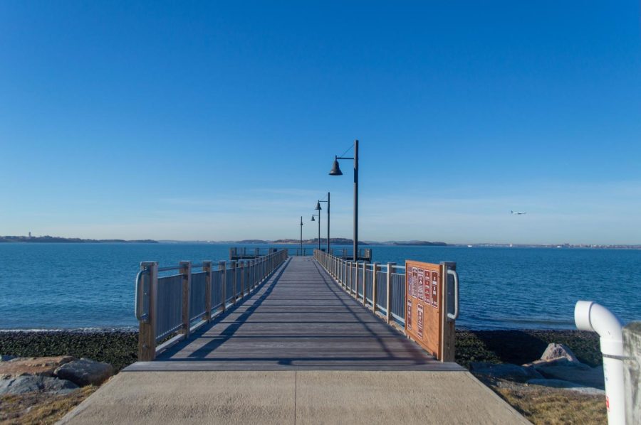
3. Deer Island — approximately 12.1 miles from campus
Placed at the entrance, a sign welcomes visitors to Deer Island near Winthrop. The island has been home to the Deer Island Wastewater Treatment Plant since 1995, which is a cornerstone of several initiatives to protect Boston Harbor against pollution from the city. (Pavithra Rajesh)A road winds around the edge of Deer Island. The island, one of 34 in the Boston Harbor Islands National and State Park, has been an ideal getaway location, with ample space to take a relaxing walk or to simply enjoy the fantastic views. (Pavithra Rajesh)A dock stretches out into the harbor off Deer Island. With its open spaces and wastewater treatment structures, the island has been an interesting combination of the natural and urban worlds. (Pavithra Rajesh)Benches line a path through the island. While the island has been known as a recreational spot to many, it also holds a troubling past as a Native American internment island during King Philip’s War from 1675-1676. (Pavithra Rajesh)
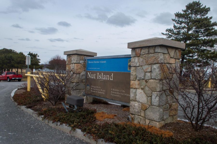
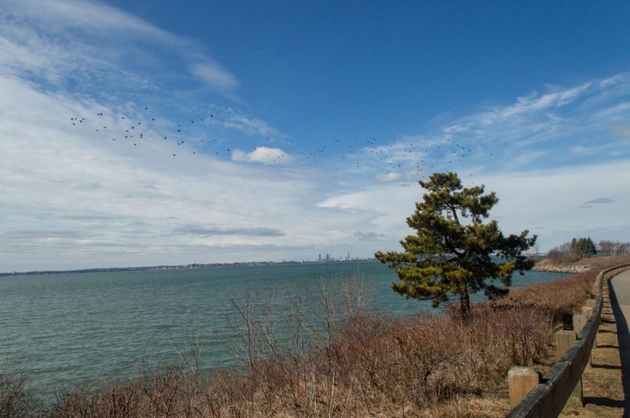
4. Nut Island — approximately 12.7 miles from campus
A sign welcomes visitors to Nut Island near Quincy. The island had recently started working in conjunction with the Deer Island Wastewater Treatment Plant. (Pavithra Rajesh)A flock of birds soar above Boston Harbor on a sunny but windy day. A paved path outlined the entirety of Nut Island, offering a relaxing opportunity to take a walk and enjoy the picturesque views. (Pavithra Rajesh)Benches are stationed throughout the island for visitors to use. With plenty of green spaces around, it is no surprise the island was used by colonists to graze cattle. (Pavithra Rajesh)
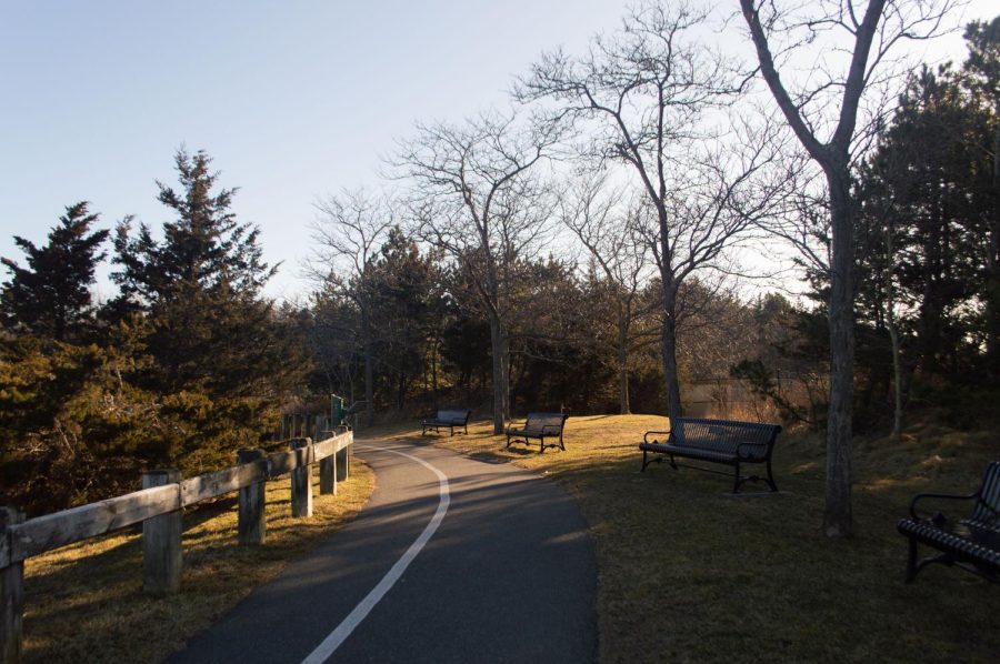
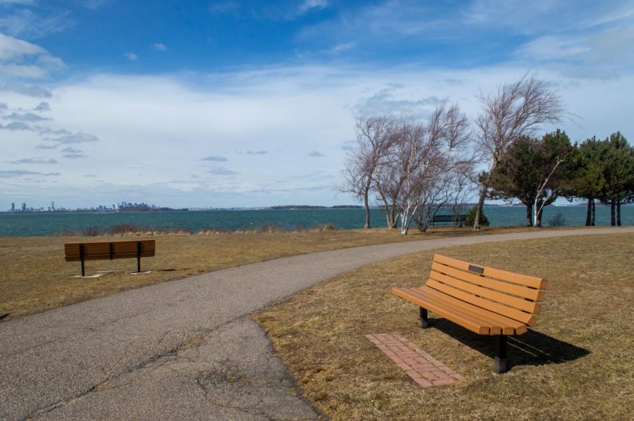
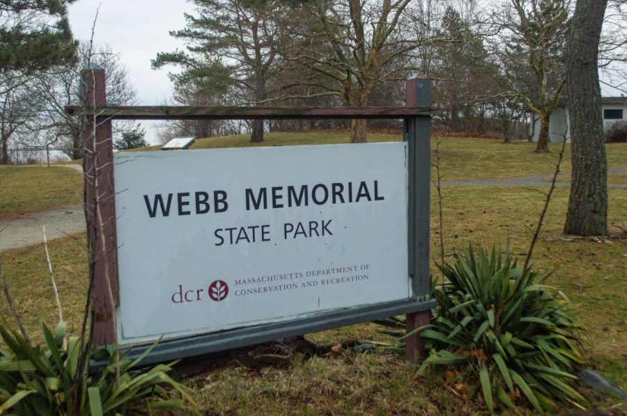
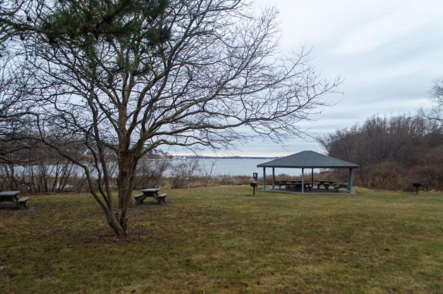
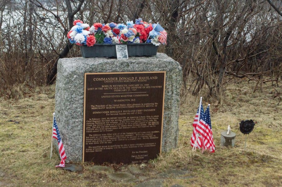
5. Webb Memorial State Park — approximately 14.6 miles from campus
A sign marks Webb Memorial State Park in Weymouth. This peninsula extending into Hingham Bay used to provide natural resources for the several indigenous communities that lived in the area. (Pavithra Rajesh)Picnic tables and a gazebo overlook the Weymouth Fore River. Even on a rainy day, there were a handful of people around, taking their early-morning walks and enjoying the views. (Pavithra Rajesh)An engraved memorial for Donald F. Haviland, a U.S. merchant marine, is framed by several American flags. In 1945, Haviland was working on an American Liberty Ship when it was attacked by German planes. When passengers and crew members escaped into lifeboats, Haviland gave up his spot to a younger man, dying shortly after. (Pavithra Rajesh)
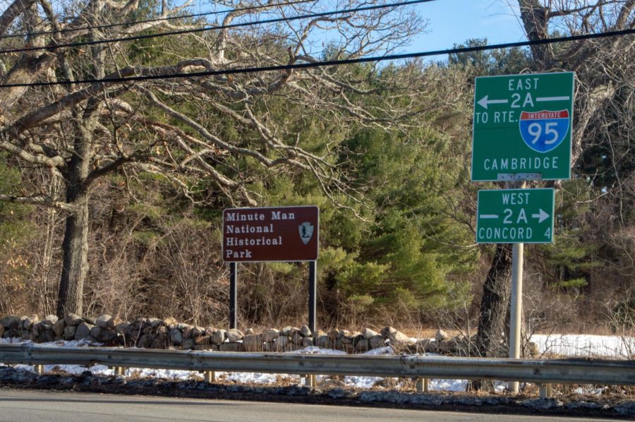
6. Minute Man National Historical Park — approximately 14.7 miles from campus
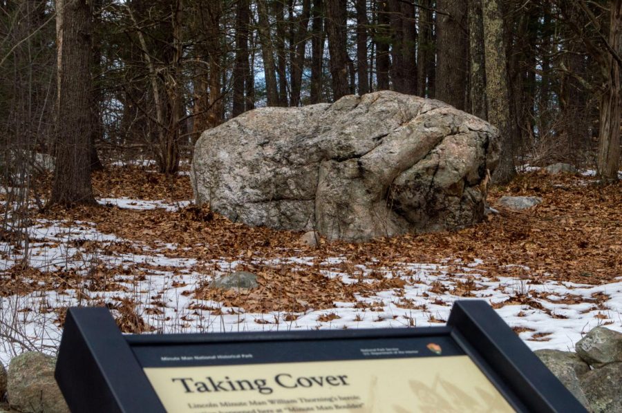
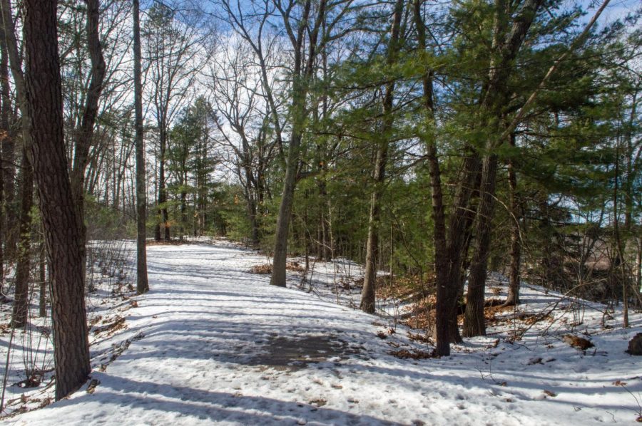
A sign on the side of the road marks the area near Minute Man National Historical Park in Lincoln. The park has been open from sunrise to sunset every day, all year. (Pavithra Rajesh)An informational sign stands near the historic “Minute Man Boulder” site. According to locals, in 1775, Lincoln Minuteman William Thorning hid behind a boulder in this pasture during a pursuit of the British column. (Pavithra Rajesh)The snow starts to clear up on a path through Minute Man National Historical Park. Walkways wound through patches of trees and greenery and crossed intermittent roads and parking lots. (Pavithra Rajesh)
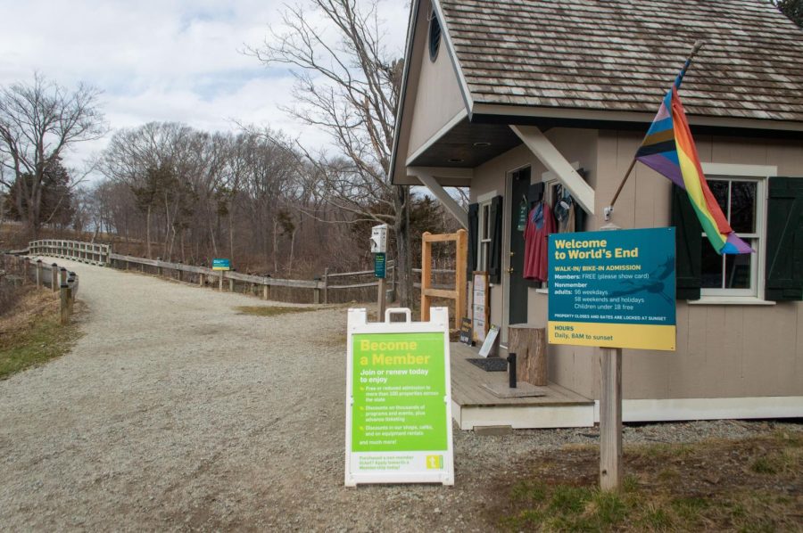
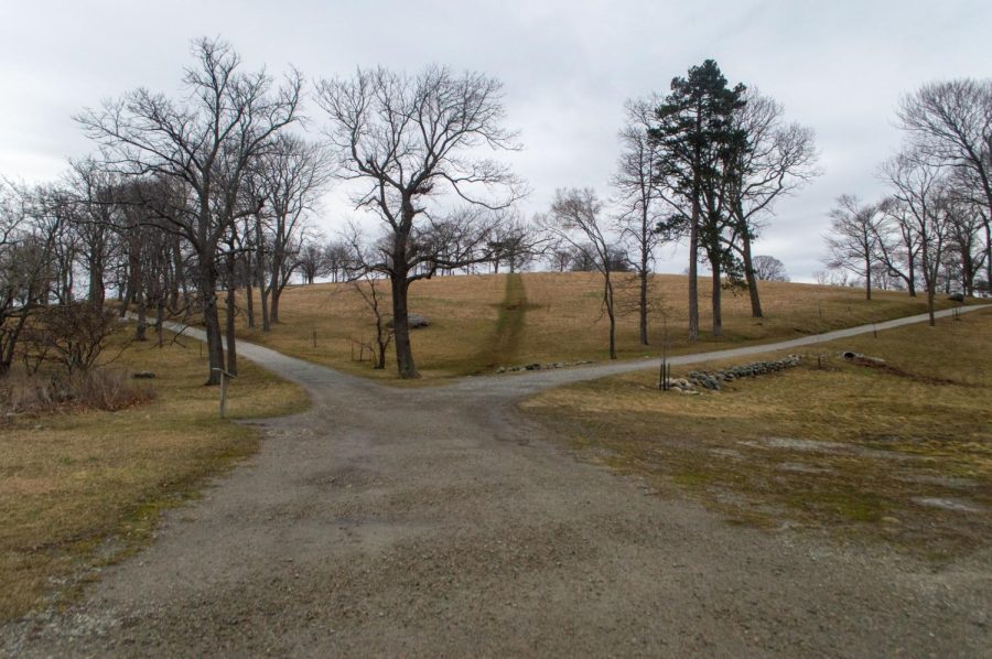
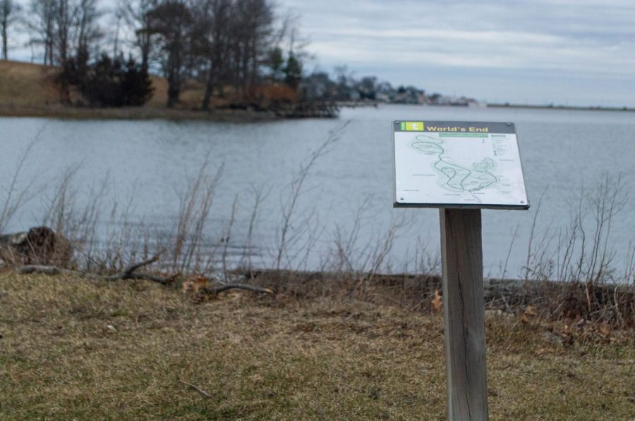
7. World’s End — approximately 17.6 miles from campus
Informative signs and a LGBTQ+ progress pride flag welcome visitors to World’s End in Hingham. Few people know this island was almost the site of the United Nations headquarters. (Pavithra Rajesh)Paths diverge through the island on a calm afternoon. The 274-acre island has been perfect for a day of several leisure activities, whether that be hiking, picnicking or even horseback riding. (Pavithra Rajesh)A sign depicting a map of World’s End stands against the water. While the park was relatively empty around March, it quickly becomes crowded during the summer, especially as many events are hosted then. (Pavithra Rajesh)
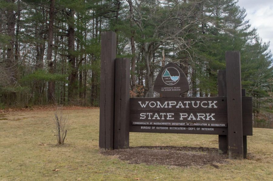
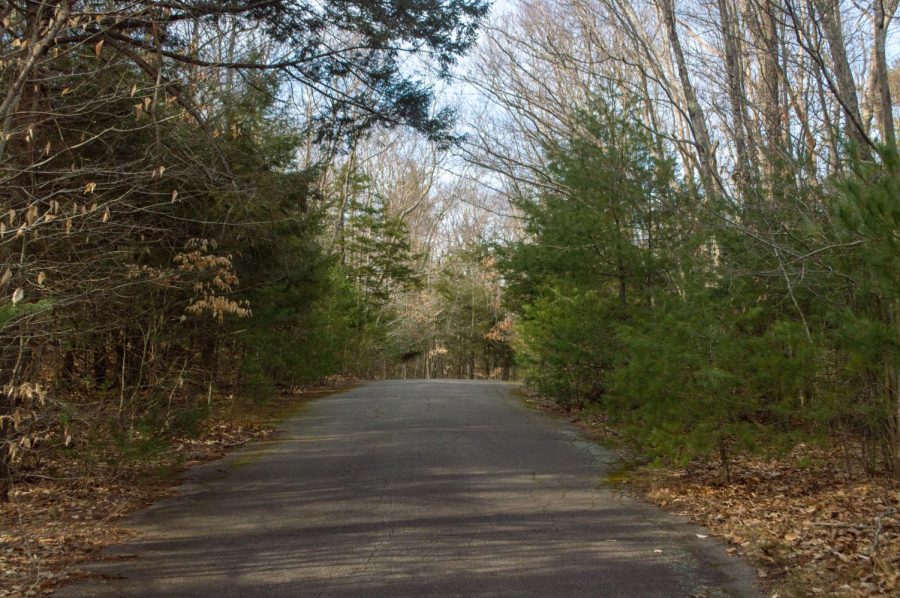
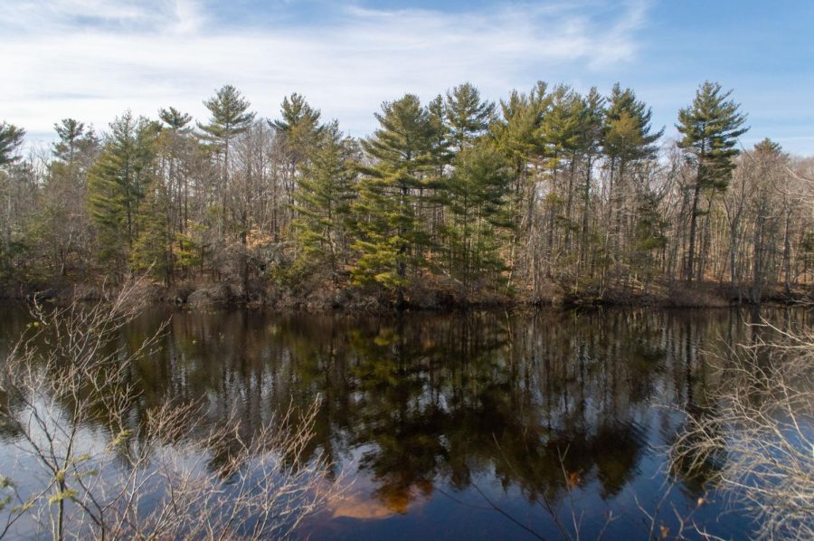
8. Wompatuck State Park — approximately 23.2 miles from campus
A wooden sign stands tall at one of the entrances to Wompatuck State Park in Hingham. The park was large, to say the least –– spanning 3,526 acres of forest, streams and ponds. (Pavithra Rajesh)Shrouded by trees and dried leaves, a road leads further into Wompatuck State Park. The park offered over 250 camping sites and has been a perfect place to get lost — ideally, not literally — in nature. (Pavithra Rajesh)In a corner of the forest, trees offer a brilliant reflection off a lake. Wompatuck State Park was named after its earliest known owner, Josiah Wompatuck, who was chief of the Mattakeesett tribe. (Pavithra Rajesh)
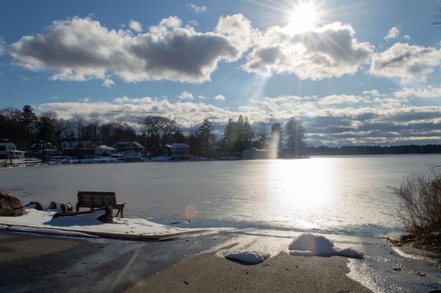
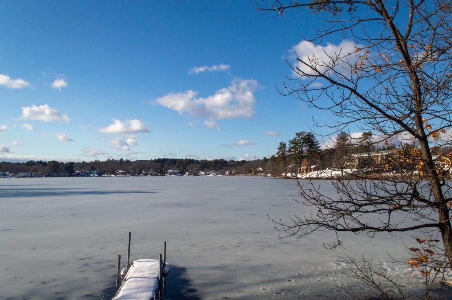
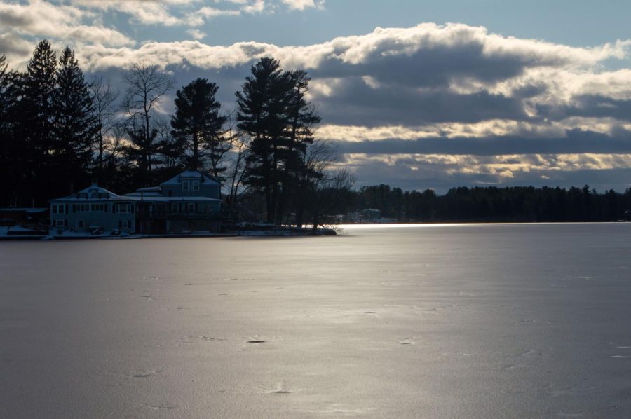
9. Mascuppic Lake — approximately 39.3 miles from campus
Close to sunset, a bench overlooks Mascuppic Lake in Tyngsboro. The lake was 217 acres and had a maximum depth of 31 feet. (Pavithra Rajesh)Buildings and houses surround Mascuppic Lake in Tyngsboro. Though emptier in the winter, the lake has been a very popular recreational spot during the warmer summer months for swimming, boating and water skiing. (Pavithra Rajesh)Clouds darken the sky over the frozen lake. At the edge of the lake was the Lakeview Conservation Area, although it seemingly only included a small patch of greenery and a parking lot. (Pavithra Rajesh)
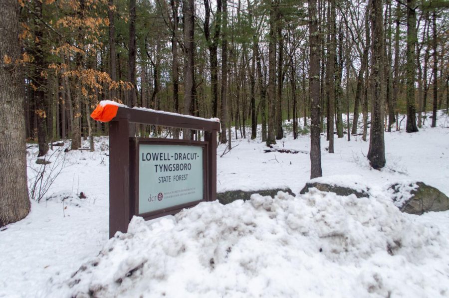
10. Lowell-Dracut-Tyngsboro State Forest — approximately 39.6 miles from campus
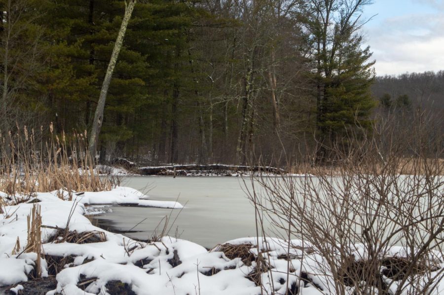
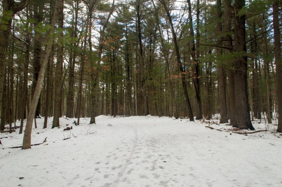
On a snowy afternoon, a sign welcomes visitors to the Lowell-Dracut-Tyngsboro State Forest which spreads across those three towns. The forest spanned over 1,000 acres and had six miles of trails for hiking, biking or skiing. (Pavithra Rajesh)A frozen pond lines a path through the forest. The forest was thought to be a site of a Native American settlement prior to colonization. (Pavithra Rajesh)Footprints decorate a snowy path through Lowell-Dracut-Tyngsboro State Forest. Even in the winter, the quiet, open space is an enjoyable — and nearby — escape from the bustling city life. (Pavithra Rajesh)