
New exhibit at Leventhal Map and Education Center centers of environmental injustice
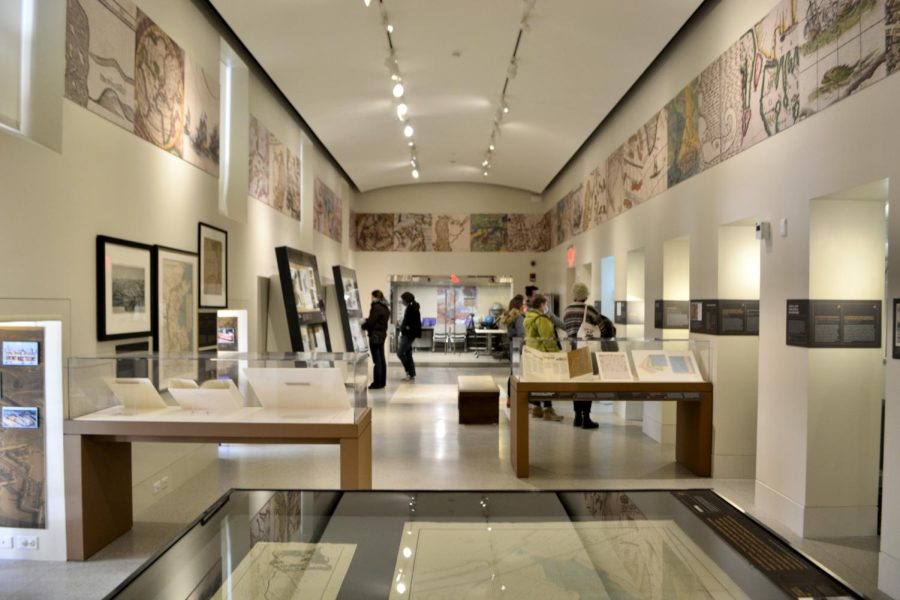
The Norman B. Leventhal Map Center at the Boston Public Library highlights historic maps and plans through a social justice lens. Photo credit to Colette Pollauf.
April 3, 2022
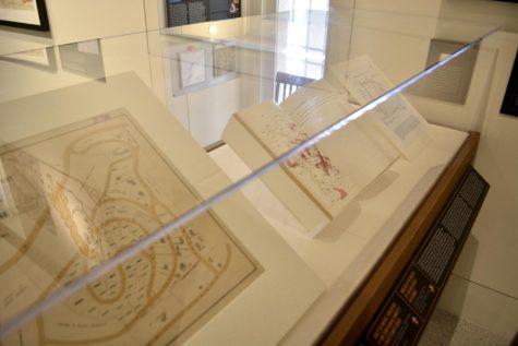
Boston Public Library’s Leventhal Map and Education Center opened a new exhibit titled “More or Less in Common: Environment and Justice in the Human Landscape” mid-March. The exhibit will run through December 2022, located between the courtyard and the new section of the Copley branch. The exhibit features maps, interactive data visualizations, text and videos exploring the relationship between social justice and the environment. It is free to visitors and is open Monday through Saturday.
Visitors can start at the right side of the long rectangular room where they will find historical maps and text about indignous culture and how the land was used by Native Americans. As visitors walk through, they will find newer diagrams showcasing different issues, such as noise and light pollution in Boston and maps of underdeveloped land, or land owned by the government. In addition to analyzing texts, there are blurbs about different community activists and how the topic explored in that section of the exhibit impacts their community. President and Head Curator Garrett Dash Nelson said looking back is essential to plan ahead.
“Oftentimes, environmental justice is seen as a modern concern … but what we wanted to look at is [the] centuries worth of environmental injustices, as well as attempts to address social issues through reshaping the environment,” Nelson said. “And to think about the legacy that’s left with the present day, as well as how we might center some of those concerns looking into the future.”
Robert Kearns, a climate resilience specialist for the Charles River Watershed Association, as well as outings and conservation chair for the Massachusetts Sierra Club, spoke about the movement against a compressor station in the South Shore in a video presentation shown at the exhibit. Fore River Residents against the Compressor Station, or FRRACS, works to educate people on the environmental and health threat that the compressor station poses and take action against it. Documents regarding the Compressor Station and the danger it poses accompany the video.
Another feature of the exhibit is an interactive touch screen where visitors can select a map and play around with different factors. The data visualizations were made by the Leventhal Center using public data from the City of Boston. One of the displays allows users to toggle between the current water level and the predicted water level in ten years. Another allows visitors to see where the air pollution in the United States has the worst effect on the health of nearby communities.
At the back of the exhibit, there is a separate room containing books about maps, learning tools for children and part of the BPL’s collection of stereographs primarily used for educational purposes. Stereographs are viewed through a headset held on a wooden stick called a stereograph and create an almost 3D image. According to the accompanying text, they allow viewers to “enter the scene and examine the details of the photograph.” Some of the stereograph images available in the room included pictures of bridges, woods, or farms.
The Leventhal Center typically hosts school groups from as young as kindergarten up to college age. Students learn critical research skills, how to read primary sources, how to read maps and are given tours of the current exhibit.
Back in the main room, visitors are greeted with a display on the future. Taken from student studies and projects at Northeastern University and University of Pennsylvania, the maps look at what the future of environmental justice could look like. Nelson plans on rotating these maps as more research comes out. The people featured are also going to be changed throughout the exhibition to give voice to more community members.
“We see this as a living exhibition and a site for people from the community to get involved with telling their own stories,” Nelson said.
The exhibit is funded in part by the Institute of Museum And Library Services, which is a federal organization that supports library work, as well as private donors, grants and BPL itself.
Although it is located in the heart of Back Bay, the exhibit does not focus solely on Boston maps and local issues. One section discusses “Cancer Alley” in the Mississippi River and how the toxic health concerns relate to social justice issues. Another map about the U.S. border also touches on social justice and immigration issues.
“My favorite part was the colored maps. I really like how it touches on worldly issues, especially South America, Colombia and Venezuela,” said visitor Eva Martinez, a clinical research coordinator at Massachusetts General Hospital.
Michael Boensel, senior software engineer at John Galt Staffing, was showing his parents around the city when they stumbled upon the Leventhal Map and Education Center.
“The library is a great place. I enjoyed [the exhibit], I think it’s interesting,” Boensel said.
The Boston Public Library has over a quarter million cartographic and geographic objects including maps, data sets, atlases, globes and charts. The Leventhal Center also has a prolific digital collection of resources in addition to the physical items in the Copley library.
“Our focus is on helping people think about maps not just as these dry documents that show where things are, but instead as an invita-
tion to think about spaces, places and people,” said Nelson.